Aim
The purpose of this project was to investigate the presence of, and map, potential voids underneath the working level of an active quarry. Such voids posed a serious H&S concern to quarry operations.
Approach
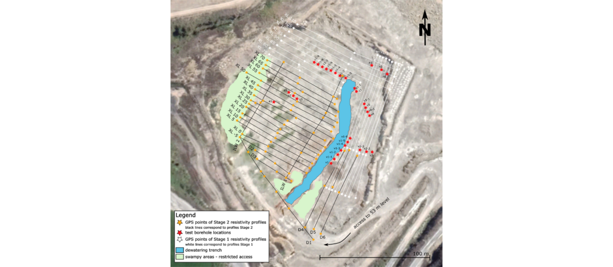
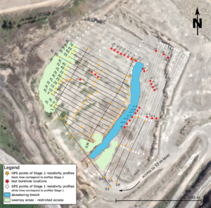
A grid of Electrical Resistivity Tomography (ERT) measurements was undertaken across the working level of the quarry (see below). The resistivity contrast between air-filled or water-filled voids and surrounding rock makes ERT a well-suited technique for identifying and mapping such subsurface voids. ERT lines were positioned as well as possible to cover all accessible parts of the quarry, enabling a pseudo-3D model of the substructure across the whole site to be constructed.
Results
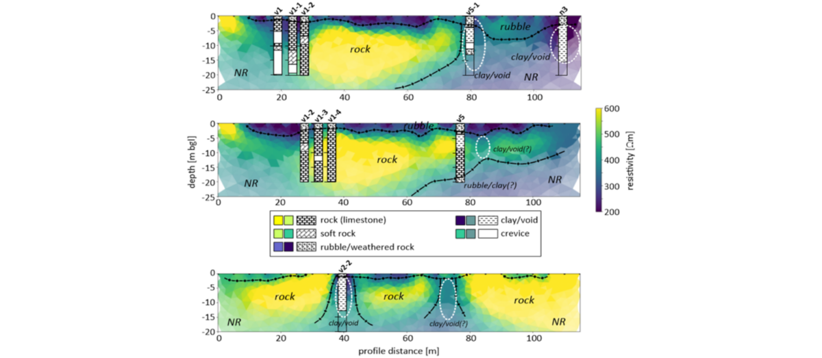
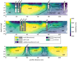
The below figure displays the ERT models obtained along three example profiles in the quarry. Yellow areas (high resistivity) indicate competent rock whereas blue areas (low resistivity) indicate the locations of rubble (weathered rock) at the surface and deeper voids filled with clayey saline mud. Targeted boreholes were drilled to confirm the findings of the ERT survey, with over 80% of the identified voids and features verified by the drilling.
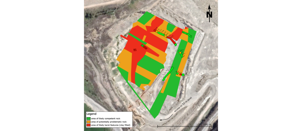
A hazard map of the quarry, indicating where karstic voids and channels were identified, was produced using the results of the ERT survey and boreholes. The geophysical information formed the base of this map, a result impractical from drilling alone on the roughly 15,000 m2 site.
Outputs & Value
Through the results of the geophysical investigation and boreholes, it was evident that significant areas of voids/karstic channels were present close to the surface of the quarry. This was reinforced when a section of the quarry floor lifted during drilling due to pressure release. As a result, the working floor was closed for work involving heavy machinery, due to health and safety concerns. Using the risk map produced from geophysical results, mining engineers were able to work on a plan for safely mining the remaining rock from the quarry.
Such mapping is also relevant for new subdivisions or infrastructure in karstic terrain to determine the presence and location of any subsurface voids or karstic features.
Contact our Geophysics Team
geophysics@coco.co.nz
Wellington (+64) 04 472 7282
Christchurch (+64) 03 365 5960