Electrical Resistivity Tomography
Electrical Resistivity Tomography (ERT) is where the resistance of ground layers is measured.
Electrical Resistivity Tomography (ERT) is where the resistance of ground layers is measured.

Click below to learn more about the science behind it all.
Multi-channel Analysis of Surface Waves (MASW)
Seismic Refraction Tomography (SRT)
Ground Penetrating Radar (GPR)
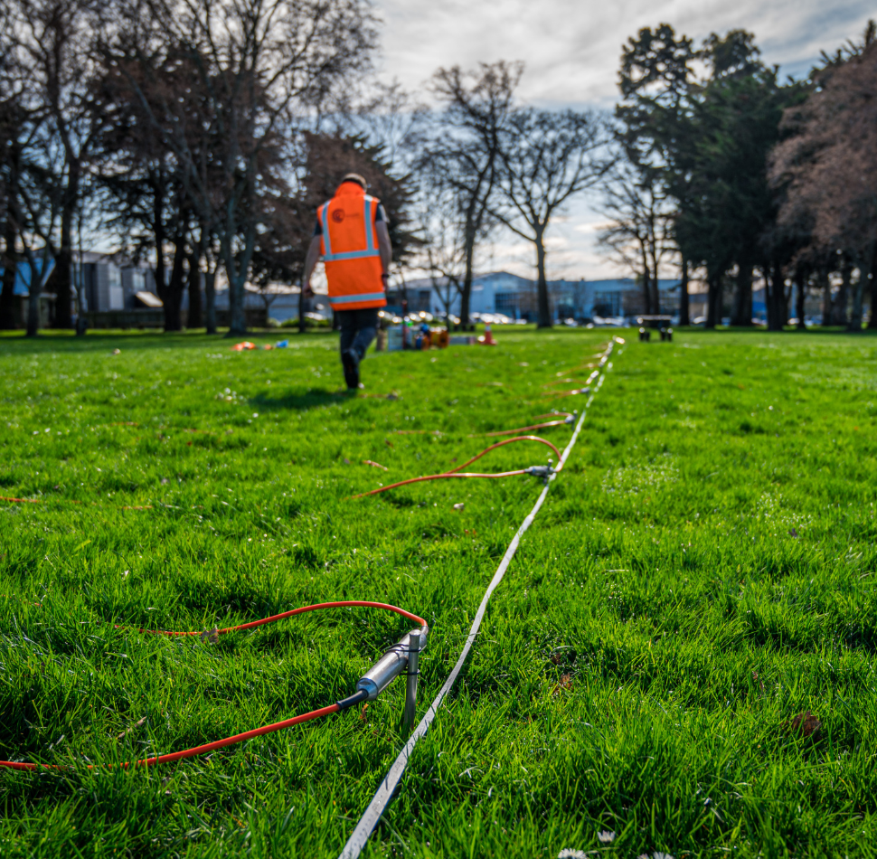
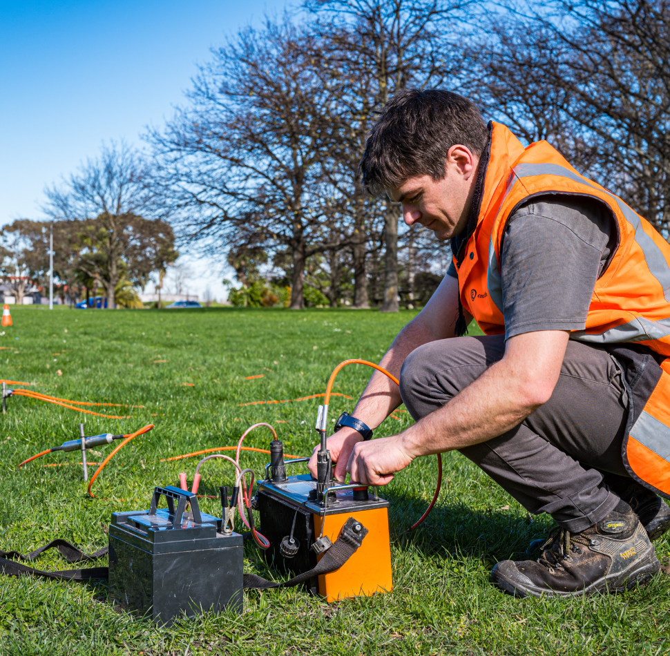
ERT data is collected by inducing current into the ground between electrodes, and the potential difference is then found using a different pair of electrodes. In the field, a series of electrode pairings are planted in the ground at regular intervals within the test area and are connected to a central control unit. ERT can generate a 1D sounding, as well as 2D or 3D profiles.
ERT has many applications and can be used for projects including:
Read about our previous ERT projects:
"*" indicates required fields
Find out how Cook Costello can help.