
Geophysical Surveys
Understanding what lies below the surface before you design, dig or build reduces risk and improves decisions. Cook Costello’s geophysicists work within our engineering team, so subsurface findings are interpreted in context and applied directly to the project, not handed over as a standalone survey.

Why having geophysics in-house matters
Many engineering firms bring in geophysics as an outside service when they need it. At Cook Costello, geophysicists are part of the team. That changes how quickly we can respond, how directly findings feed into design, and how useful the work is to the project overall.
We get to site early, before assumptions become embedded in the design. Our geophysicists work alongside our geotechnical and civil engineers, so results are interpreted in the context of the project from the outset. Where a standalone survey may hand over data for others to interpret, our approach means findings can shape decisions as the work develops.
That helps target further investigation where it will add the most value, reduce unnecessary conservatism in design, and identify issues before they become programme or cost problems on site.
We work across Northland, Auckland, Wellington and Christchurch, and support building, infrastructure and land development projects nationwide.
OUR CAPABILITIES
How we can help you
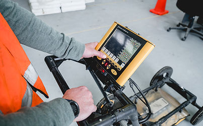
Geophysics helps you understand what lies beneath the ground without excavation. Using fast, non-invasive investigation methods, we identify subsurface patterns, anomalies and risk areas across your site, helping reduce uncertainty, target intrusive investigation and avoid late design rework or construction delays.


OUR PROCESS
How geophysical surveys are delivered
Every site is different. The steps below outline how a typical geophysical investigation progresses, depending on your project objectives, site constraints and ground conditions.

We deliver answers, not just data
Plenty of providers can run a geophysical survey and hand you the data. The harder part is knowing what it means for your project. That is where having geophysics inside an engineering firm changes things. Our geophysicists interpret the results themselves and work directly with our geotechnical, civil and structural engineers, so you get a clear answer about your site and next steps, not just passing a dataset between consultants.
In practice, the survey is designed around the engineering questions that matter. The results are interpreted by people who understand how they affect design, consenting and construction matters, and the findings feed directly into the work that follows. On a Northland limestone quarry, that meant mapping voids across the site and confirming them with targeted drilling, so the operator could plan excavation around known ground risks before they became safety or production issues.
Selected projects across New Zealand


See what's underground before decisions get expensive
Tell us about your site and the works you’re planning. Our geophysics team will advise on the right survey methods, what they can tell you about the ground, and the next steps, whether you’re at feasibility, design or preparing to break ground.